Property Record
998 Of, , GA


Property Detail
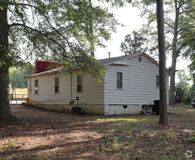
998 Of
Atlanta-Sandy Springs-Roswell, GA
TRACT 1
05-22-00-010
FAYETTE
Residentialacreage
Georgia
B and X Area of moderate flood hazard, usually the area between the limits of the 100-year and 500-year floods.
1 AC
2024
Fayette/Peachtree
2025
Atlanta
140404
NEARBY LISTINGS FOR SALE OR LEASE
DEMOGRAPHICS near 998 Of
1 mile
3 mile
5 mile
2025 Total Population
2,950
28,465
55,465
2030 Population
3,121
29,859
58,040
Pop Growth 2025-2030
+ 5.80%
+ 4.90%
+ 4.64%
Average Age
45
43
43
2025 Total Households
1,248
10,693
20,130
HH Growth 2025-2030
+ 6.01%
+ 5.06%
+ 4.76%
Median Household Inc
$65,514
$97,494
$102,896
Avg Household Size
2.30
2.60
2.70
2025 Avg HH Vehicles
2.00
2.00
2.00
Median Home Value
$309,135
$399,487
$400,955
Median Year Built
1992
1995
1993
Nearby Places
Map Layers
Map Styles
 Street
 Aerial
Transit
 Traffic
 Biking
Places
Listings with unknown addresses are not visible on the map
- Restaurants
- Banks
- Shops
- Fitness
- Groceries
PUBLIC TRANSPORTATION
AIRPORT
Hartsfield - Jackson Atlanta International
Drive
Walk
Distance
Hartsfield - Jackson Atlanta International
30 min
17.4 mi
Freight Ports
Georgia Ports - Savannah
Drive
Walk
Distance
Georgia Ports - Savannah
274 min
239.0 mi
Nearby Properties
Address
Land Use
TOTAL SIZE
Lot Size
Zoning
Address
Land Use
TOTAL SIZE
Lot Size
Zoning
816,050 SF
82.46 AC
C BP
Address
Land Use
TOTAL SIZE
Lot Size
Zoning
165,632 SF
40.14 AC
C OI
Address
Land Use
TOTAL SIZE
Lot Size
Zoning
194.98 AC
PCD
Address
Land Use
TOTAL SIZE
Lot Size
Zoning
565,679 SF
288.50 AC
PCD
Address
Land Use
TOTAL SIZE
Lot Size
Zoning
386,872 SF
PCD
Address
Land Use
TOTAL SIZE
Lot Size
Zoning
224,116 SF
41.20 AC
MUC
Address
Land Use
TOTAL SIZE
Lot Size
Zoning
155,706 SF
6.86 AC
PCD
Address
Land Use
TOTAL SIZE
Lot Size
Zoning
316,880 SF
285.84 AC
PCD
Address
Land Use
TOTAL SIZE
Lot Size
Zoning
197,026 SF
28 AC
Address
Land Use
TOTAL SIZE
Lot Size
Zoning
245,406 SF
51.77 AC
Address
Land Use
TOTAL SIZE
Lot Size
Zoning
84,975 SF
3.60 AC
PCD
Address
Land Use
TOTAL SIZE
Lot Size
Zoning
230,474 SF
288.50 AC
PCD
Address
Land Use
TOTAL SIZE
Lot Size
Zoning
92,424 SF
11.59 AC
C PUD
Address
Land Use
TOTAL SIZE
Lot Size
Zoning
81,154 SF
23.70 AC
C OI
Address
Land Use
TOTAL SIZE
Lot Size
Zoning
2,660 SF
C BP
Address
Land Use
TOTAL SIZE
Lot Size
Zoning
40,392 SF
0.54 AC
C OI
Address
Land Use
TOTAL SIZE
Lot Size
Zoning
158,310 SF
4.76 AC
C C1
Address
Land Use
TOTAL SIZE
Lot Size
Zoning
260,883 SF
21.30 AC
C C3
Address
Land Use
TOTAL SIZE
Lot Size
Zoning
111,198 SF
8.94 AC
C C1
Address
Land Use
TOTAL SIZE
Lot Size
Zoning
39,704 SF
2.43 AC
C OI
Address
Land Use
TOTAL SIZE
Lot Size
Zoning
96,018 SF
PCD
Address
Land Use
TOTAL SIZE
Lot Size
Zoning
92,550 SF
10.70 AC
C C1
Address
Land Use
TOTAL SIZE
Lot Size
Zoning
56,415 SF
2.44 AC
PCD
Address
Land Use
TOTAL SIZE
Lot Size
Zoning
106,727 SF
25.85 AC
PCD
Address
Land Use
TOTAL SIZE
Lot Size
Zoning
5,654 SF
22.78 AC
C RMF15
Address
Land Use
TOTAL SIZE
Lot Size
Zoning
120,793 SF
5.60 AC
C PUD
Address
Land Use
TOTAL SIZE
Lot Size
Zoning
45,824 SF
4.84 AC
C OI
Address
Land Use
TOTAL SIZE
Lot Size
Zoning
220,887 SF
24.70 AC
Address
Land Use
TOTAL SIZE
Lot Size
Zoning
122,568 SF
24.50 AC
PCD
Address
Land Use
TOTAL SIZE
Lot Size
Zoning
107,232 SF
13.82 AC
C C3
The World's #1 Commercial Real Estate Marketplace
Connect with us
© 2026 CoStar Group
The information above has been obtained from sources believed reliable. While we do not doubt its accuracy we have not verified it and make no guarantee, warranty or representation about it. It is your responsibility to independently confirm its accuracy and completeness. Any projections, opinions, assumptions, or estimates used are for example only and do not represent the current or future performance of the property. The value of this transaction to you depends on tax and other factors which should be evaluated by your tax, financial, and legal advisors. You and your advisors should conduct a careful, independent investigation of the property to determine to your satisfaction the suitability of the property for your needs.